MapEM
MapEM
Wavecontrol
Wavecontrol MapEM Electromagnetic Maps - Asessement of exposure levels over large areas of cities or territories
MapEM RF Electromagnetic Field Level Maps
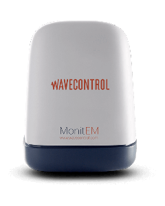
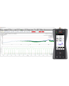
The Wavecontrol MapEM system consists of a MonitEM monitoring device and control software. The MapEM creates a comprehensive map of electromagnetic field levels covering a large area, such as a city. The monitoring device can be easily installed on a vehicle to measure the electric field strength (V/m) as it drives around streets, providing a clear view of the RF field levels throughout the area.
Resistant to extreme weather conditions
MapEM devices have an environmental protection rating of IP 66, the highest in its class, meaning that they are dust tight and resistant to powerful water jets. A protection rating of IP 66 is indispensable for vehicle-mounted equipment since they must work outdoors while exposed to precipitation of any intensity and air-borne particles (dust and vehicle emissions).
MapEM Key Features:
- Detection of sensitive points - with high radiation levels, to take corrective measures.
- Comprehensive assessment - of electromagnetic exposure at street level in large areas (cities)
- Year-on-year comparison - to assess developments in NIR levels depending on changes to infrastructure or technology.
- Visual communication tool - to allow simple presentation of the public’s exposure to electromagnetic fields.
Click below to request a quote for this item. Or for product advice, stock and lead time enquiries call our team on 0330 313 3220.
| Attribute | Value |
|---|---|
| Dimensions | 70 x 40 x 8 cm |
| Frequency Range | Depending on field probe |
| Sensor Type | Isotropic, RMS |
| Results | Display software / database |
| Memory Capacity | Micro SD (1 GByte) + Eeprom |
| Data Downloading | Georeferenced data in Access, KML, or CSV format |
| Compatible Field Probes |
|
| Temperature Range | - 25 ºC to + 60 ºC |
| Features |
|
| Attribute | Value |
|---|---|
| Data Sheet | Click here to view |


